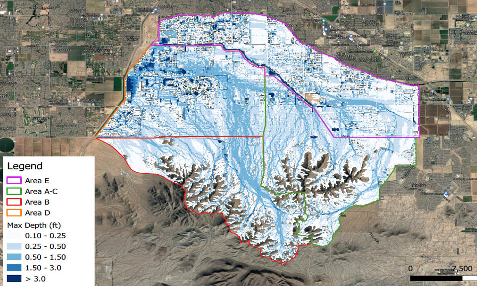
The San Tan West ADMP covers a watershed area in excess of 45.8 square miles. The watershed’s character varied between the undeveloped steep mountainous areas in the upper reaches and sparsely and densely developed areas within the lower regions. This ADMP included a complex FLO-2D model creation in areas where man-made disturbances have introduced channel systems, drainage structures, and retention systems. The large area included multiple municipalities where stakeholder and public involvement were critical for the project’s success.

Let’s Build Something Great Together